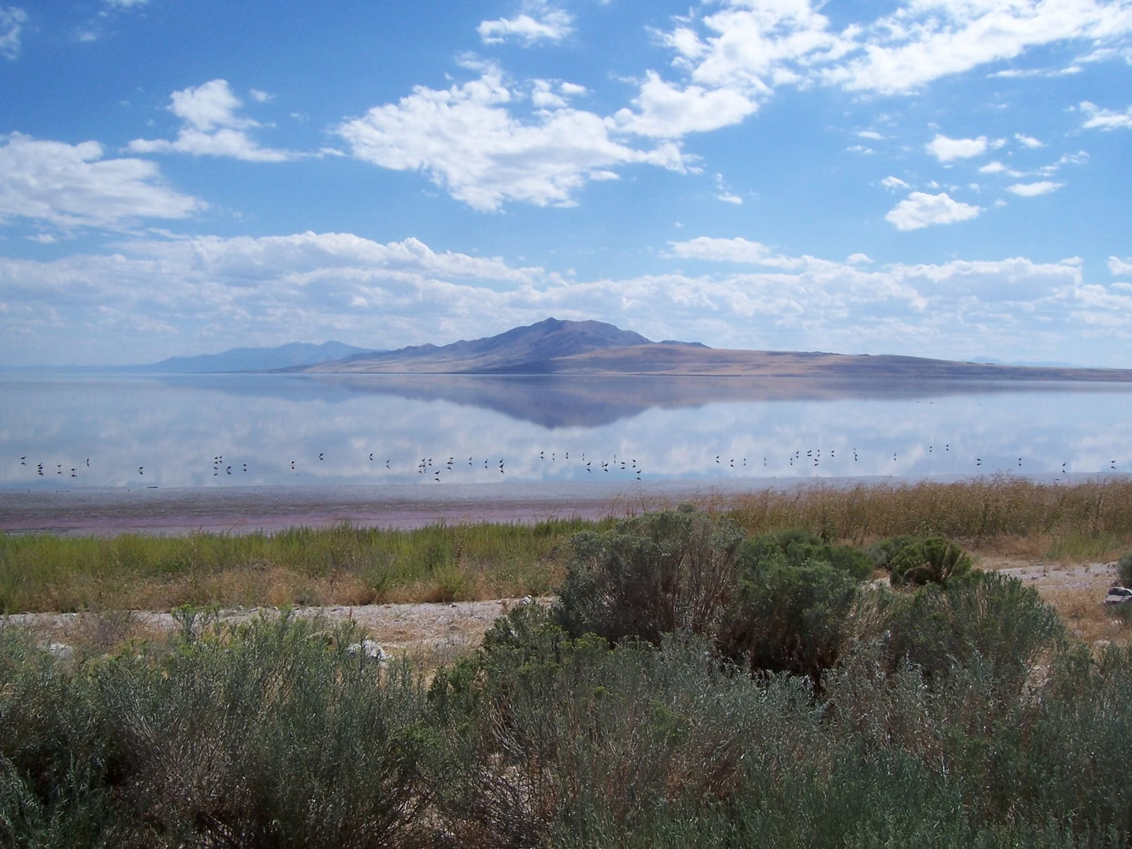
About Antelope Island
Antelope Island is the largest island in Great Salt Lake and a Utah state park: 28,022 acres of grassland, sagebrush and rocky ridges, 15 miles long and 4.5 miles wide, rising to Frary Peak at 6,596 feet. Explorer John C. Fremont named it in 1845 for the pronghorn his party hunted there. Ranchers ran cattle, sheep and bison on it from 1848 until the State of Utah bought it, the north end in 1969 and the rest in 1981. It is not a national park; Utah State Parks manages it.
The Island at a Glance
How Antelope Island Got Its Name
In 1845, on his second trip to the area, John C. Fremont, traveling with Kit Carson, hunted pronghorn on the island and named it Antelope Island in gratitude for the meat. Pronghorn were long called antelope, though they aren't true antelope (Wildlife & Birds).
People on the Island
Artifacts show people lived on the island more than 6,000 years ago. The Fremont people camped here 500 to 2,000 years ago, and the Ute people used the island until the late 1840s.
Ranching Years, 1848 to 1981
- 1848: Fielding Garr brings the church's cattle over and builds the ranch house that still stands (Fielding Garr Ranch).
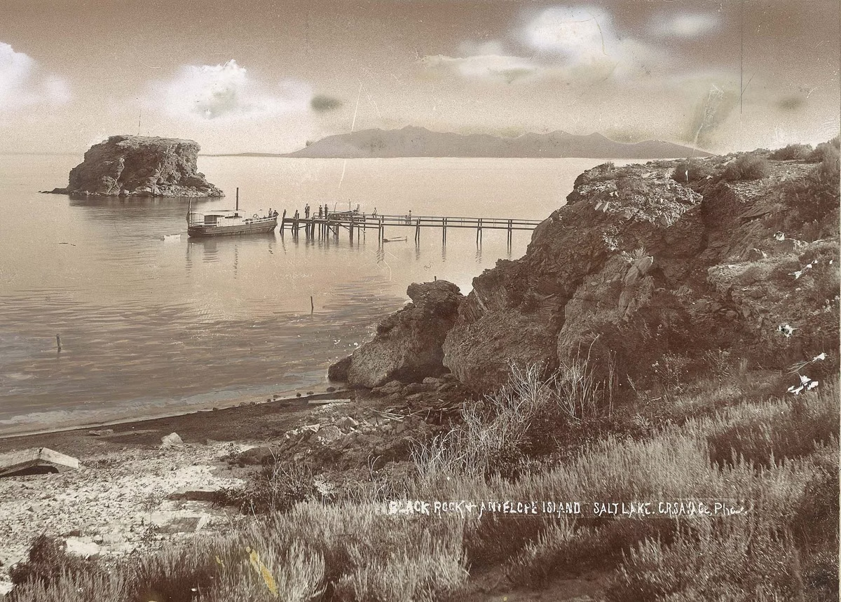
- 1854: rising water ends wagon access, and Brigham Young builds a boat, the Timely Gull.
- 1884: John Dooly and Fredrick Meyers form the Island Improvement Company, which runs the island for decades.
- 1891: George Frary homesteads four miles north of the ranch house; the island's highest peak shares the Frary name.
- 1893: 12 bison arrive, the start of today's herd (Bison).
- 1922: scenes of The Covered Wagon are filmed with the bison herd at what is now Camera Flats.
- 1951: the company switches from sheep to cattle and builds a southern causeway.
- 1979–80: about 16 million cubic yards of fill are dug from the north end for interstate highways and carried away on a 13-mile conveyor belt, at the time the longest ever built.
Becoming a State Park
- 1969: Utah buys 2,000 acres at the north end and creates the state park; the causeway from Syracuse is finished.
- 1981: the state buys the southern 26,000 acres.
- 1983: rising lake water floods the causeway and the park closes.
- 1987: the lake peaks at 4,211.85 feet above sea level, and the first bison roundup is held.
- 1992–93: the causeway is rebuilt and the park reopens to the public; pronghorn are reintroduced.
- 1997: 23 bighorn sheep are reintroduced.
- 2000: the Fielding Garr Ranch reopens.
- 2026: the expanded visitor and learning center is complete (Visitor Center).
Geology: Some of Utah's Oldest Rock
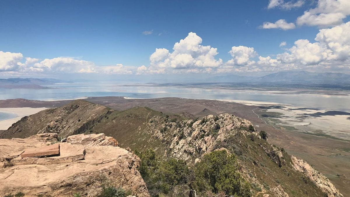
The island is part of the basin-and-range country between the Wasatch and the Sierra Nevada. Its southern two-thirds is the Farmington Canyon complex, banded, contorted rock about 1.7 billion years old, the same age as the rocks at the bottom of the Grand Canyon. The northern third is Tintic Quartzite, about 550 million years old, laid down in a shallow sea; you can see it around the Visitor Center. The youngest rock is tufa from Lake Bonneville, 10,000 to 15,000 years old, visible from the Buffalo Point Trail. Four ancient Lake Bonneville shorelines can be seen from the island.
Great Salt Lake
Great Salt Lake is the largest natural lake west of the Mississippi, a remnant of Ice Age Lake Bonneville, which covered more than 20,000 square miles. At its average level it is about 75 miles long and 28 wide. It has no outlet, so it is far too salty for fish, but brine shrimp and brine flies feed millions of migrating birds (Bridger Bay Beach).
Dark Skies
In spring 2017 Antelope Island was designated an International Dark Sky Park (Bronze tier). The park holds star parties and astronomy programs, and Utah State Parks notes that winter, with its early sunsets, is a good time for stargazing.
About Antelope Island FAQ
Is Antelope Island a national park?
No. It is a Utah state park, managed by the Utah Division of State Parks.
Why is it called Antelope Island?
Explorer John C. Fremont named it in 1845 after his party hunted pronghorn, then called antelope, on the island.
How big is Antelope Island?
28,022 acres, about 15 miles long and 4.5 miles across at its widest. It is the largest island in Great Salt Lake.
When did Antelope Island become a state park?
Utah created the park in 1969 on 2,000 acres at the north end and bought the remaining 26,000 acres in 1981. After flooding closed it in 1983, it reopened in 1993.
Is Antelope Island good for stargazing?
Yes. It has been an International Dark Sky Park since 2017, with star parties and astronomy programs.